Experiment Design of PRECIP 2022
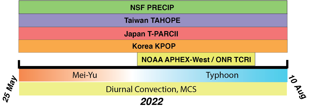
PRECIP will be conducted 25 May – 10 August 2022 to study extreme rainfall in Meiyu front, Mesoscale convective systems, diurnal convection, and typhoons
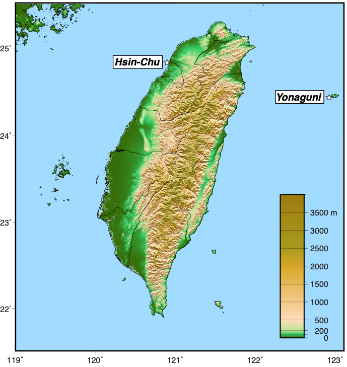
The experimental design of PRECIP is motivated by four key factors: 1) a moisture-rich environment, 2) the presence of both complex terrain and an oceanic environment, 3) a dense operational observing network to augment the specialized field observations, and 4) a high frequency of a variety of heavy rainfall events. Taiwan and the western North Pacific region are a natural laboratory that optimizes all four of these criteria.
Ground-Based Observations
Observations will be collected by the NSF/NCAR S-PolKa and CSU SEA-POL radars, radiosondes, and disdrometers.
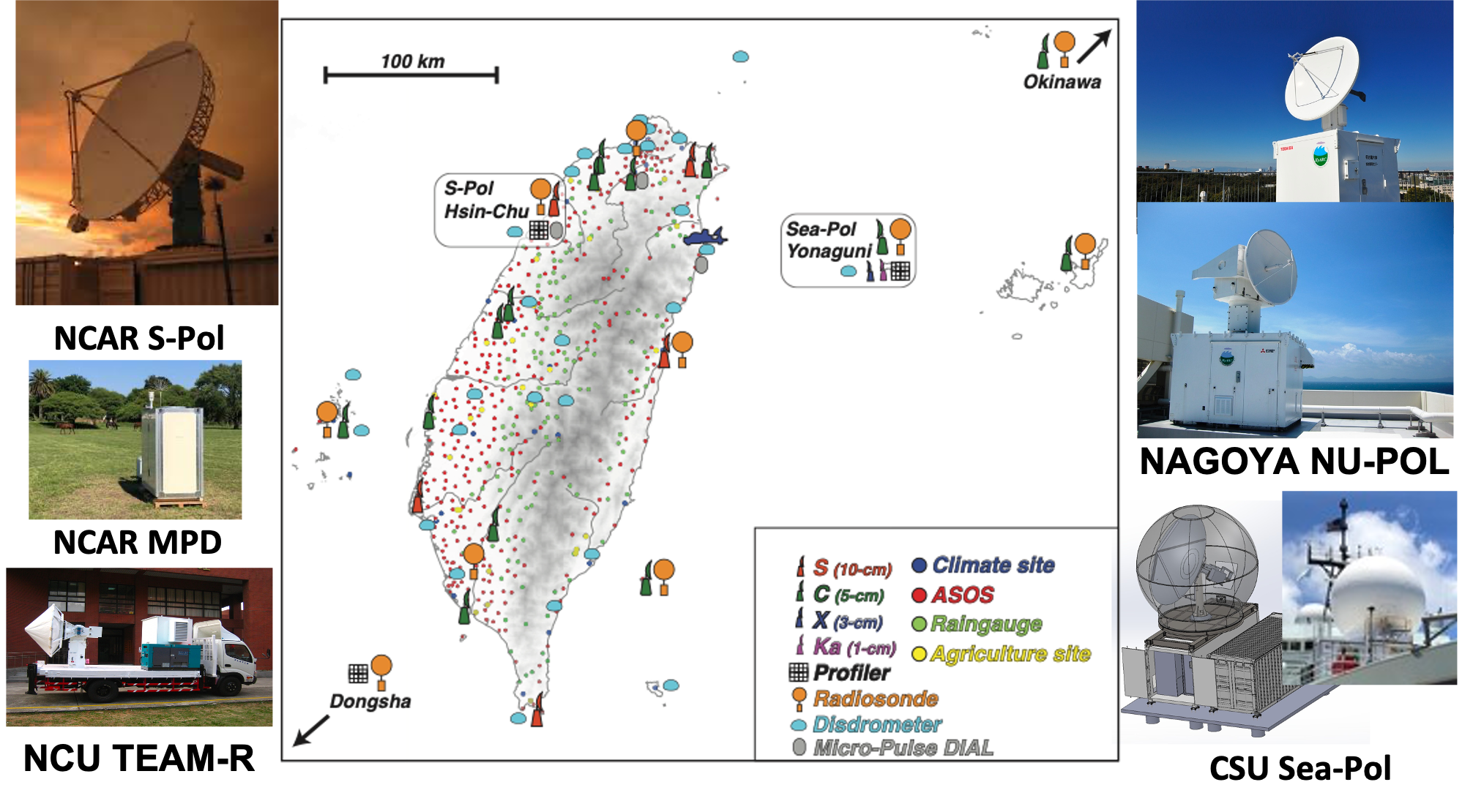
- NCAR S-Pol
- S-band (10-cm) research radar for minimal attenuation in heavy rain
- Highest quality polarimetric measurements using alternating H/V signals
- SoWMEX/TiMREX (2008), DYNAMO (2011), PECAN (2015)
- CSU Sea-Pol Radar
- Recently built using Major Research Instrumentation award from NSF
- C-band (5-cm) polarimetric research radar built for harsh environments
- Successful deployments in SPURS-2 (2017) and PISTON (2018, 2019)
- NCAR Micro-Pulse Differential Absorption LIDAR (DIAL)
- Accurate, continuous profiles of water vapor every 5 minutes in clear-air
- Low-cost, low-maintenance, long life & stable for unattended operations
- Eye-safe & invisible radiation
Airborne Observations
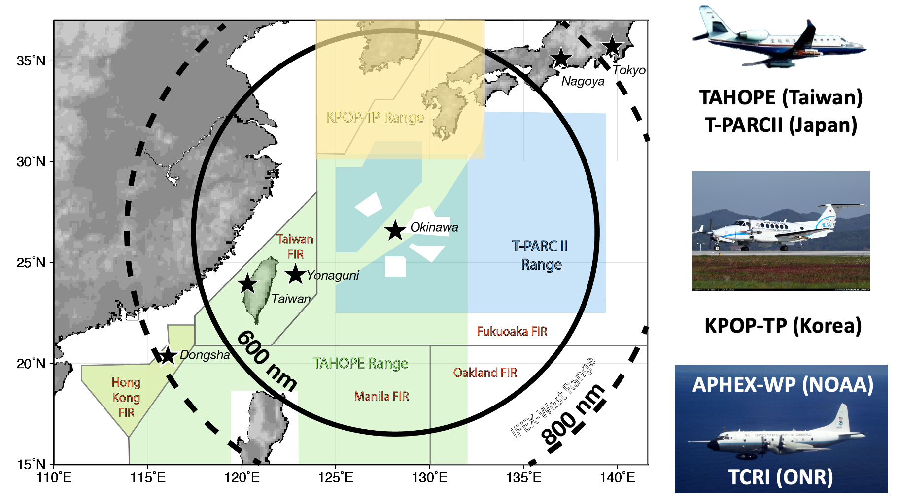
Three aircrafts will be available during the PRECIP: Taiwan ASTRA, Korean King-Air, and NOAA P-3. NOAA P-3 will be operated in a partnership with NOAA APHEX-West / ONR TCRI in July 2022.
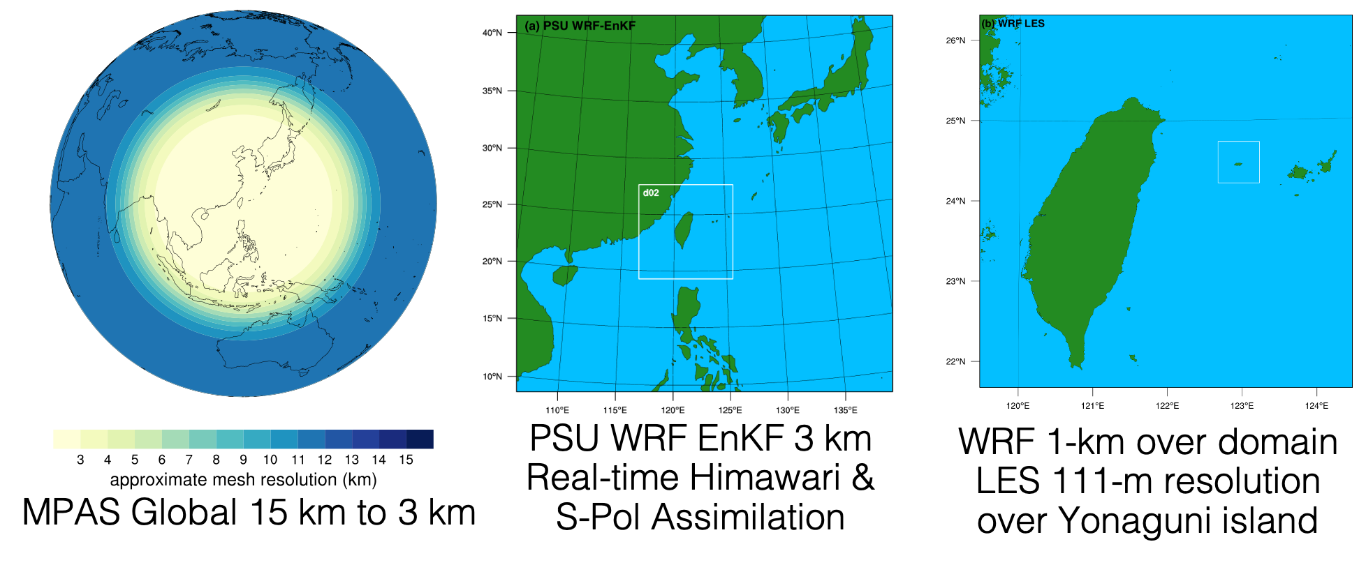
Modeling
For real-time modeling, the Model for Prediction Across Scales (MPAS) will be used for global scale, and convectionpermitting Weather Research and Forecasting (WRF) model for the area of interest.